Remote sensing is an indirect exploration method for the contactless recording of the earth's surface with the help of satellites, aircraft or drones. It is thus a non-contact survey of distant objects and, through image data processing and evaluation, supports data interpretation with the help of statistics and space and time analyses. Remote sensing of the Earth has made it possible to obtain information about our planet quickly and over a wide area, and thus to record its condition and "state of health". Without this information technology, large-scale exploration of our Earth would actually not be possible. This promising method is a central part of the global data and information network, which is of great value to science, business and politics - for efficient resource use, sustainable land use and liveable cities. To put it in the words of the European Space Agency ESA: you measure the pulse of our planet Earth from space.
Data acquisition through remote sensing
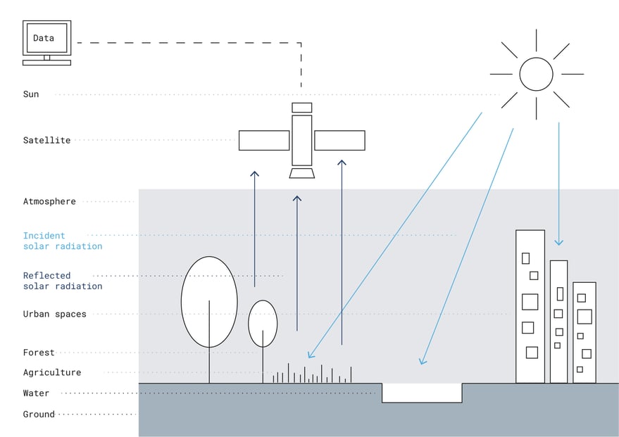
How is a remote sensing image created?
Data is created by taking images from active and passive sensors on satellites or aircraft. Most methods use light or radar waves by measuring reflected radiation or self-radiation (see graphic). With its representation in electromagnetic wavebands and spatial scales, remote sensing allows surfaces and objects to be recognised and distinguished by describing their character and texture. This makes it possible to locate them in space and record changes over time. Within geoscientific research, procedures from environmental models and geographical information systems (GIS) are used to interpret the data and thus to obtain information. Passive systems use only the electro-magnetic radiation that occurs in nature. Active systems, on the other hand, contain an energy source that artificially irradiates the earth's surface.
Source: Own illustration
Fields of application for remote sensing
for land use and biodiversity In order to record biodiversity, researchers have also been using various remote sensing methods for around 30 years. An important task of biodiversity research is to document the status quo, to investigate environmental processes and changes as well as disturbances within ecosystems (land use change, water and air pollution, loss of biodiversity, etc.). With the help of satellite images, for example, the occurrence of a tree species under investigation can be determined on the basis of growth form and leaf geometry - over large areas and over time.
in resource management and in the course of global change In the course of global change and increasing land consumption, concepts for efficient and sustainable land management are becoming internationally necessary. The use of optical remote sensing methods can provide area-wide information for this purpose. The calculation of spatial changes in cultivated areas are examples of agricultural monitoring. The aim is to reduce time and costs compared to alternative methods such as manual mapping. Research on land use changes and climate change are necessary to answer questions on sustainable resource management. The goal: to capture spatial interaction through process-oriented models and the use of modern monitoring techniques (e.g. remote sensing) and methods for processing environmental information (e.g. GIS).
in urban spaces Cities are characterised by heterogeneous, complex structures that are difficult to capture. There is a complex mixture of artificial and natural surfaces that differ significantly in size, shape and arrangement. This requires data with high geometric resolution. Remote sensing methods serve to produce high-quality basic data as a basis for a variety of urban planning, decision-making and development processes. The aim is to characterise urban areas on the basis of spatial dimensions and, for example, to record rapidly growing cities.
as a crisis information system Remote sensing can be used as a source of information in all phases of crisis management. Different data provide area-wide information on hazards, damage or affected protected assets. The crisis situation can thus be documented over a large area. Before, during and after a crisis, the EU's Copernicus programme provides satellite images and corresponding evaluations for disaster and crisis management. For example, in acute disaster situations caused by floods, storms, earthquakes, forest fires, landslides or humanitarian crises. After an event, satellite imagery of the affected areas can be used to provide information on the extent of the event (e.g. floods). In the aftermath of damage events, detailed analyses can be carried out to support the planning and monitoring of the progress of reconstruction measures. To prepare for and prevent crises, remote sensing data offer a wide range of possibilities for detailed risk analyses. In use are reference maps, damage analyses or the monitoring of reconstruction measures. Such information can support situational awareness and decision-making in crisis management.
Copernicus Network Office Municipal The use of remote sensing and Copernicus can make it easier for cities, districts and municipalities to fulfil their municipal tasks. The task of the network office is to inform and investigate how this can be done even better in the future. This concerns, for example, the areas of climate protection, air pollution control and energy; urban green spaces, environmental protection and water as well as mobility, infrastructure and civil security.
Our offer:
We inform about
Applications of Copernicus data and services
Data access, integration and processing
Integration of remote sensing and Copernicus into existing workflows
Extraction of geoinformation from remote sensing systems
The network offers a platform to develop tailor-made support measures in dialogue, to communicate competences and to promote exchange.
The Copernicus Network Office Kommunal is operated by EurA, supported by EFTAS Fernerkundung Technologietransfer GmbH and the Deutscher Dachverband für Geoinformation e.V. (DDGI). It is funded by the Federal Ministry of Digital Affairs and Transport (BMDV). The German Space Agency at the German Aerospace Center (DLR) is the project management organisation.
Become part of our network, contribute your questions, requirements and needs and benefit from our expertise.
On our website you will also find detailed information on the topic areas as well as current best-practice projects.
Do you want to learn more about this topic? Schedule a meeting with an expert.
Thanks for reading! If you would like to learn more about this topic, I look forward talking to you. Whether you run a company, want to drive your development department forward, or work in a research institution or public facility - with us you make technical innovations possible. We have made it our business to support tomorrow's market leaders in generating ideas for innovations, developing new products and services and launching them on the international market. You and your project are always at the centre of our attention.
As one of the three funding programmes of the European Innovation Council (EIC), the EIC Pathfinder starts at the very beginning of a good idea. The ...
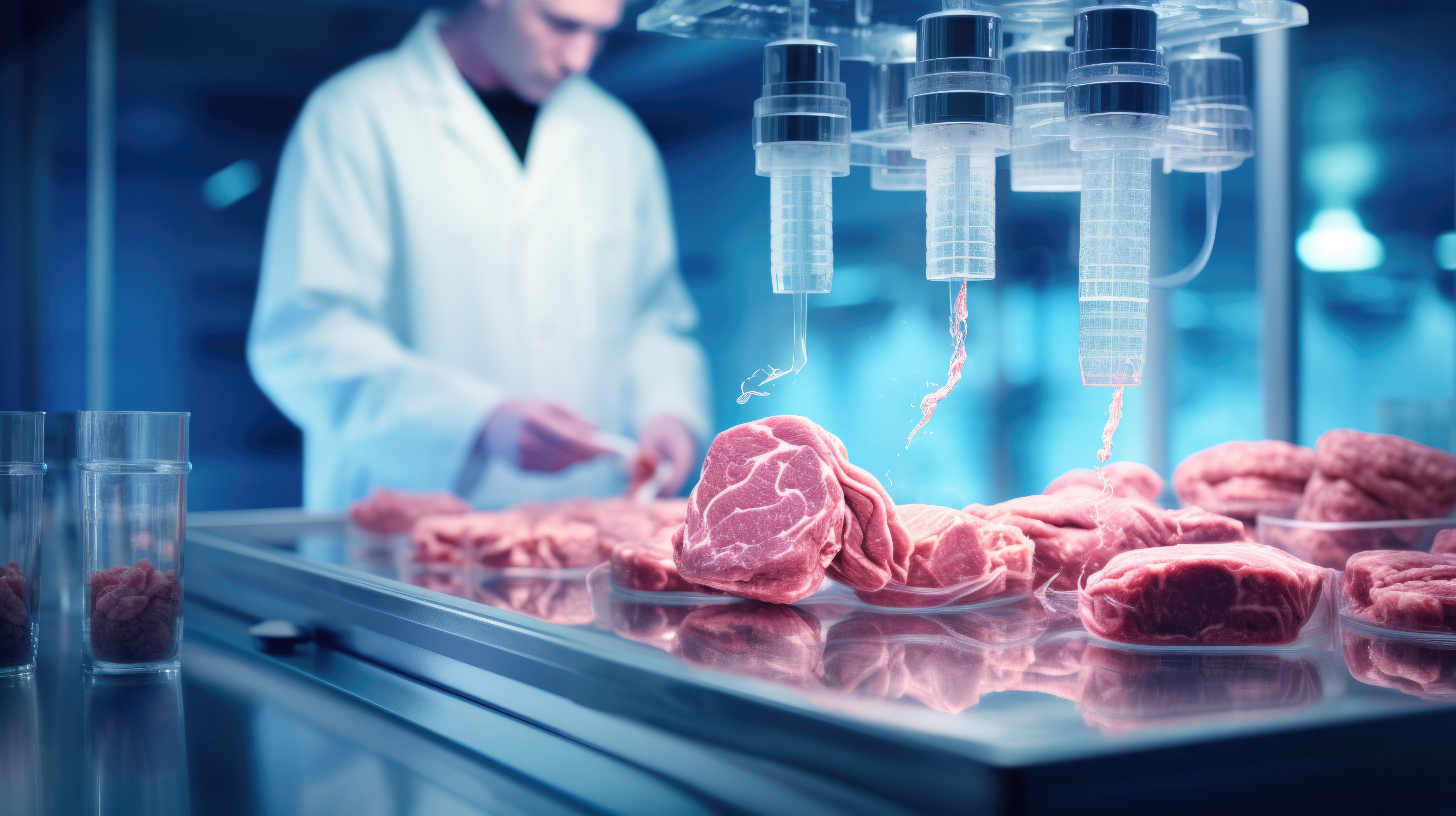
In the current food system, animal farming contributes to 17% of total greenhouse gas emissions, yet it only provides 18% of global calories and 37% ...
The German Federal Ministry of Economics and Climate Protection (BMWK) is continuing to promote energy-efficient refrigeration and air conditioning ...

 Source: Own illustration
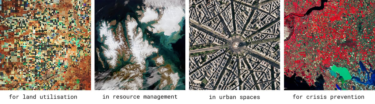


EurA AG
T- 079619256-0Max-Eyth-Straße 2
73479 Ellwangen
info@eura-ag.com